Two major earthquakes on opposite sides of the Pacific within two days have sharpened scientific and public focus on the risks of far larger seismic events—and on how little can still be predicted with certainty.
Japan’s rare megaquake advisory
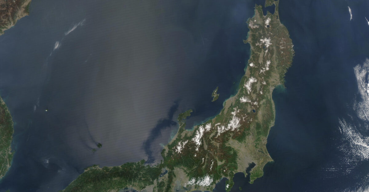
On December 8, a magnitude 7.6 earthquake struck off the coast of Aomori Prefecture in northern Japan, prompting the Japan Meteorological Agency (JMA) to issue an unusually strong advisory. It warned that there was a one percent chance a magnitude 8.0 or greater earthquake could hit within the following week, through December 16.
While a one percent probability appears low, JMA noted it was roughly 100 times higher than the usual background risk for such an event. The advisory applied across 182 municipalities along about 500 miles of shoreline, from Hokkaido in the north to Chiba Prefecture east of Tokyo. It was only the second time in three years that JMA had issued a megaquake alert of this type, underlining how seriously officials viewed the elevated seismic activity.
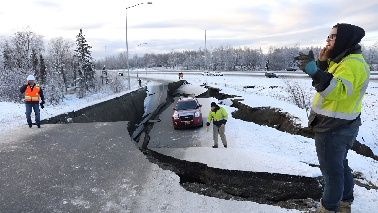
In Alaska, a magnitude 7.0 earthquake struck near Yakutat on December 6, two days before Japan’s tremor. Both events occurred along the Pacific Ring of Fire, the vast tectonic boundary encircling the ocean basin where about 90 percent of the world’s earthquakes occur each year.
Aftershocks, evacuations, and immediate damage
The Japanese quake set off an intense burst of seismic activity. Over the next three days, Japan’s monitoring network recorded 25 earthquakes in the region. The largest, a magnitude 6.7 event, struck off Aomori Prefecture on December 12, followed by a magnitude 5.7 tremor and many smaller shocks.
In Alaska, the December 6 earthquake generated 164 aftershocks in the first 24 hours alone, the strongest of which reached magnitude 5.8. While those events drew less international attention, they formed part of the same global pattern of heightened activity around subduction zones.
In Japan, authorities ordered nearly 90,000 residents to leave their homes immediately after the 7.6 quake. Around 480 people took shelter at the Hachinohe Self-Defense Forces air base, while many others stayed in local evacuation centers. Some 200 rail passengers were stranded overnight when train services were halted for safety checks.
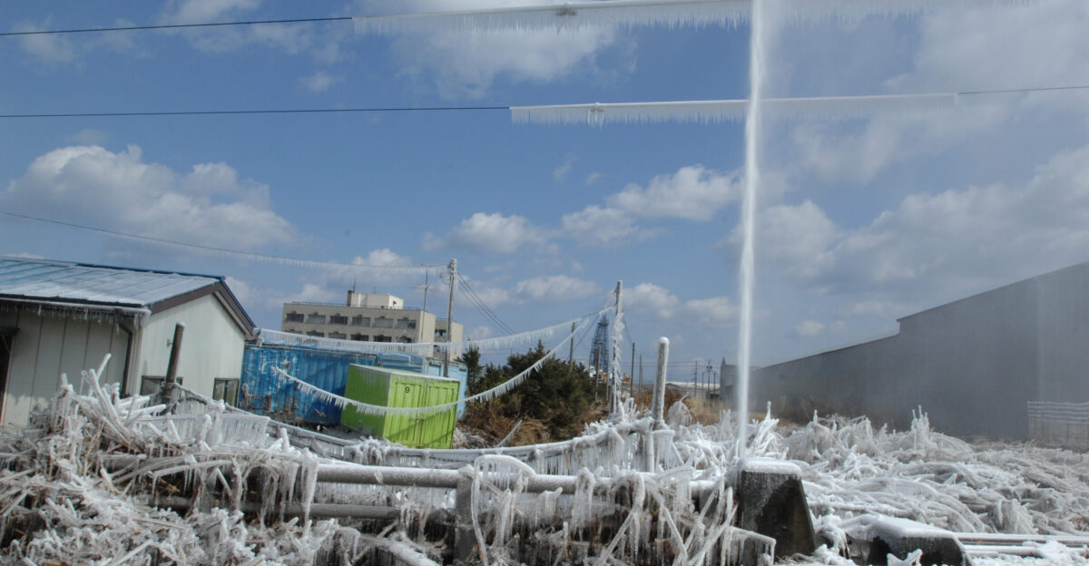
The December 8 quake left at least 30 people injured, mainly by falling debris in coastal communities. Tsunami waves up to 70 centimeters (27 inches) reached stretches of the northeastern shoreline. Several hundred homes were damaged, power failures affected thousands of households, and cracked roads slowed rescue and inspection teams.
People living inside the advisory zone were told to sleep dressed, with helmets and emergency bags at hand, so they could move quickly if a larger earthquake struck without warning.
Foreshocks, historical patterns, and scientific caution

One of the most unsettling aspects of large earthquakes is that scientists cannot immediately say whether a strong tremor is the main event or a foreshock to something bigger. An NHK reporter in Hokkaido described about 30 seconds of intense horizontal shaking during the initial quake, powerful enough that he could not remain standing, illustrating how severe a “possible foreshock” can feel on its own.
Studies of past seismic sequences indicate that roughly 15 to 43 percent of significant earthquakes are followed by an even larger rupture within days. That wide range and inherent uncertainty were key reasons JMA opted for a cautious stance.
The 2019 Ridgecrest sequence in California is a frequently cited example. A magnitude 6.4 earthquake on July 4 was initially treated as the main shock. About 34 hours later, a magnitude 7.1 quake struck the same region, causing greater damage. Seismologists estimate that this foreshock–mainshock pattern occurs in about five percent of major earthquake sequences. In Japan’s case, that small but real probability justified issuing a heightened advisory.
Life on the Ring of Fire and Cascadia’s quiet fault
The December quakes also renewed attention to the broader dangers along the Pacific Ring of Fire, where about three-quarters of the world’s active volcanoes and roughly 90 percent of annual seismic energy release are concentrated. Both the Alaska and Japan events took place along subduction zones, where oceanic plates are forced beneath continental plates, storing enormous amounts of strain.
On the eastern side of the Pacific, the Cascadia Subduction Zone remains one of North America’s most concerning faults. Stretching about 700 miles from northern California through Oregon and Washington into British Columbia, Cascadia has an estimated 37 percent chance of producing a magnitude 7.1 or larger earthquake in the next 50 years.
A full-scale Cascadia megathrust rupture could reach magnitude 9.0 or more and drive tsunamis 80 to 100 feet high, posing severe risks to millions of people in the Pacific Northwest.
Geological records show that the last confirmed Cascadia megathrust earthquake occurred on January 26, 1700. Evidence from coastal subsidence and offshore sediments suggests that great earthquakes have hit this zone at least seven times in the past 3,500 years, implying a recurrence interval of roughly 400 to 600 years. More than 324 years have now passed since the last event, placing the region within what researchers consider a statistical window of increased likelihood, even though the exact timing remains unknowable.
Global context and the limits of prediction
Worldwide, the U.S. Geological Survey’s long-term records show that the planet typically experiences about 15 to 16 earthquakes of magnitude 7.0 or higher every year. Two such events in 48 hours, as seen in Alaska and Japan, are striking but still consistent with this long-term rate. Improved detection systems now register more small earthquakes than ever before, but the overall frequency of large events has remained stable since at least 1900.
Despite more extensive monitoring and decades of data, scientists still cannot predict the exact time, place, or magnitude of future earthquakes. JMA’s December advisory was not a forecast but a statistical warning: a signal that the probability of an extreme event had risen significantly above normal levels.
Because foreshocks cannot be distinguished from mainshocks in real time, officials must balance the risk of alarming the public against the consequences of underestimating potential danger. Japan’s experience with an earlier megaquake advisory in August 2024, which led to panic buying and cancellations without a subsequent large earthquake, influenced the more measured language used in December.
When the December advisory expired on December 16 without a megaquake, residents in the affected regions could relax slightly. Yet the underlying message from seismologists remained unchanged. Along subduction zones from northern Japan to the Pacific Northwest, major earthquakes and tsunamis are considered inevitable over long timescales, even if their exact arrival cannot be forecast.
For communities living atop these restless boundaries, preparation, resilient infrastructure, and public awareness remain the most effective tools for reducing risk. The recent Alaska and Japan earthquakes served as a reminder that, while global seismic activity appears statistically normal, the stakes around the Pacific Rim are persistently high.
Sources
USGS Earthquake Hazards Program – Magnitude 7.0 Alaska Earthquake December 6, 2025
Japan Meteorological Agency – Megaquake Advisory December 8, 2025
NHK World – Mega Quake Advisory for Northern, Eastern Japan Ends December 16, 2025
The Guardian – Japan Issues Megaquake Advisory in North After Magnitude 7.5 Earthquake
U.S. Geological Survey – Global Earthquake Statistics and Long-term Records
Pacific Northwest Seismic Network – 1700 Cascadia Subduction Zone Earthquake Documentation