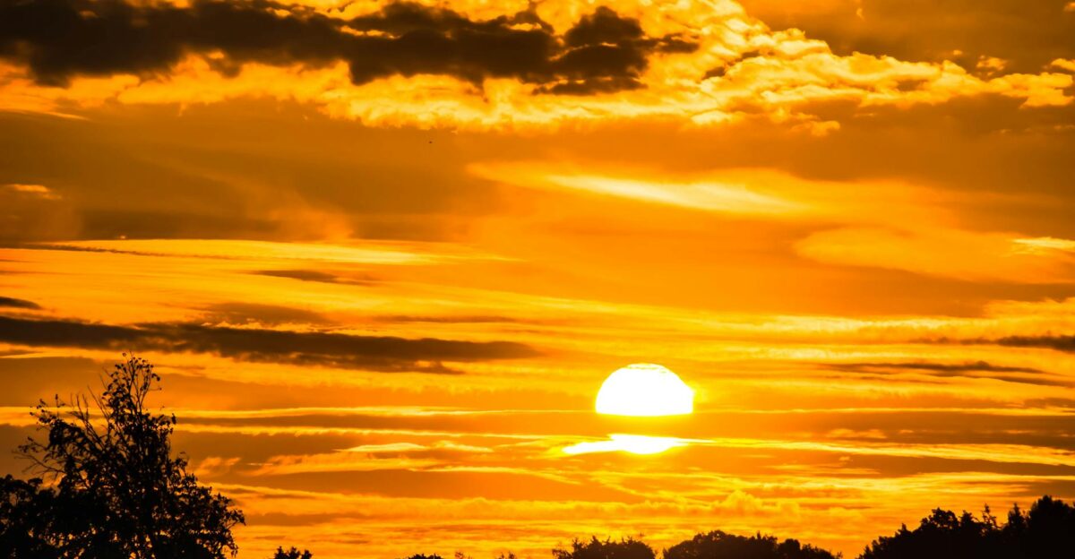
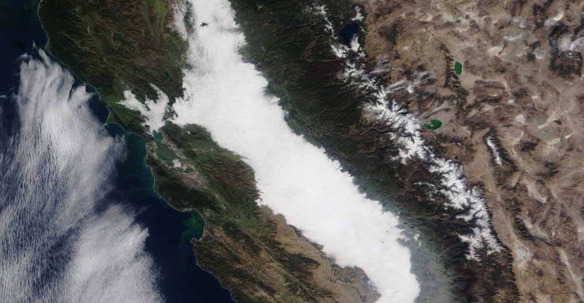
A 400-mile wall of suffocating Tule fog—so dense visibility has collapsed to 10 feet in some stretches—has transformed California’s Central Valley into a ghostly paralysis zone, swallowing entire freeways in white haze night after night for more than a week.
The phenomenon, documented by satellite imagery from the National Weather Service and SFGATE, is trapping an estimated 13 million residents in a murky twilight, forcing delivery drivers to navigate by memory, school buses to reroute on dangerous back roads, and Interstate 5—one of the nation’s critical freight arteries—into a quarter-mile visibility gauntlet.
Why ‘Radiation’ Fog Has Nothing to Do With Nuclear Risk
The term “radiation fog” may sound ominous, but meteorologists stress that it refers to how the fog forms, not to nuclear radiation. The National Weather Service explains that radiation fog develops when the ground cools at night, causing the moist air just above it to chill, and water vapor condenses into tiny droplets.
Clear skies, light winds, and high humidity create a textbook setup, especially in sheltered valleys like California’s Central Valley.
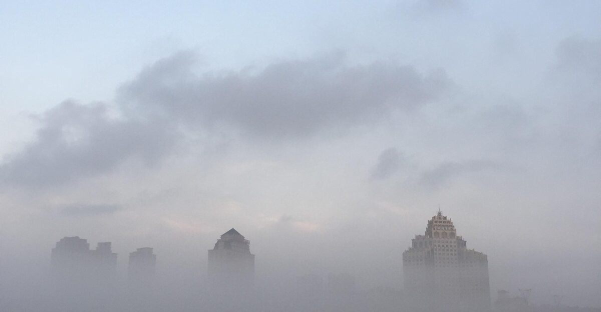
A Valley Buried in Mist
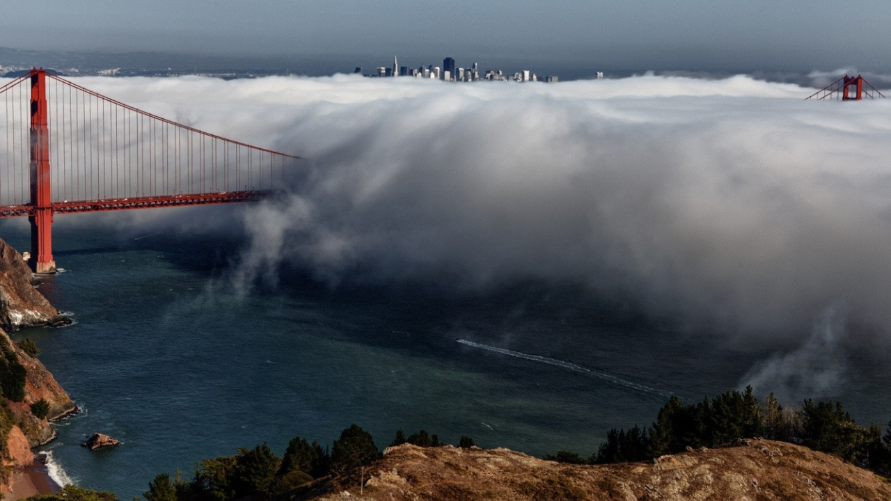
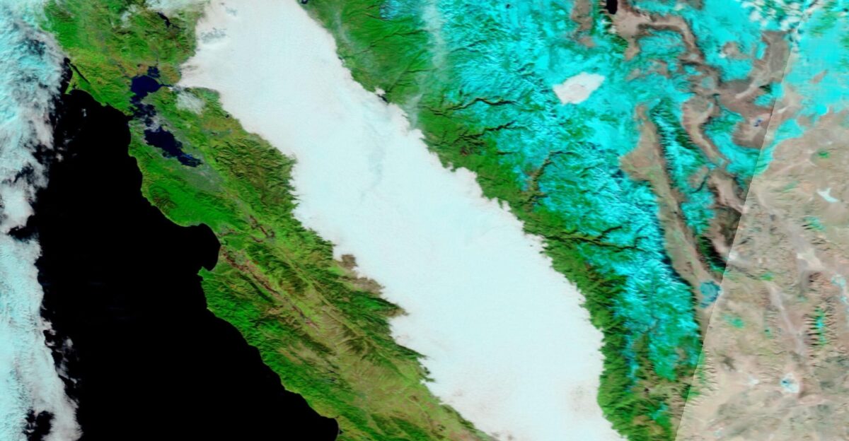
Forecasters say the current fog bank stretches roughly from Bakersfield to north of Sacramento, filling the Central Valley basin and now extending west into Bay Area counties. Satellite loops show a solid white stripe of cloud pinned between the Coast Ranges and the Sierra Nevada, a near‑continuous ribbon of fog hundreds of miles long.
For communities along that corridor, the sun has struggled to break through for days.
The Fog That Refuses to Leave
Instead of burning off for good, this Tule fog has re‑formed night after night for more than a week, forecasters say. After late‑autumn storms soaked the region, a high‑pressure system settled in, producing calm, cold nights that trap moisture near the ground.
Each evening, temperatures slide back toward the dew point, and the same fog layer blooms again before dawn, with no clear end date yet in sight.
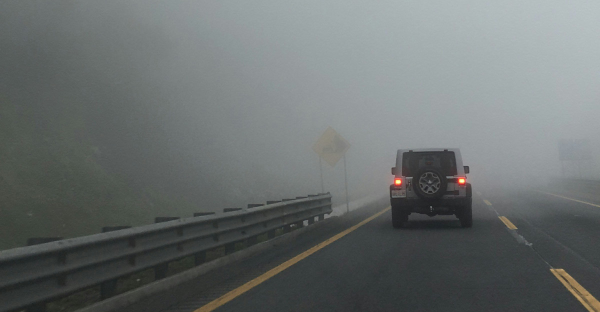
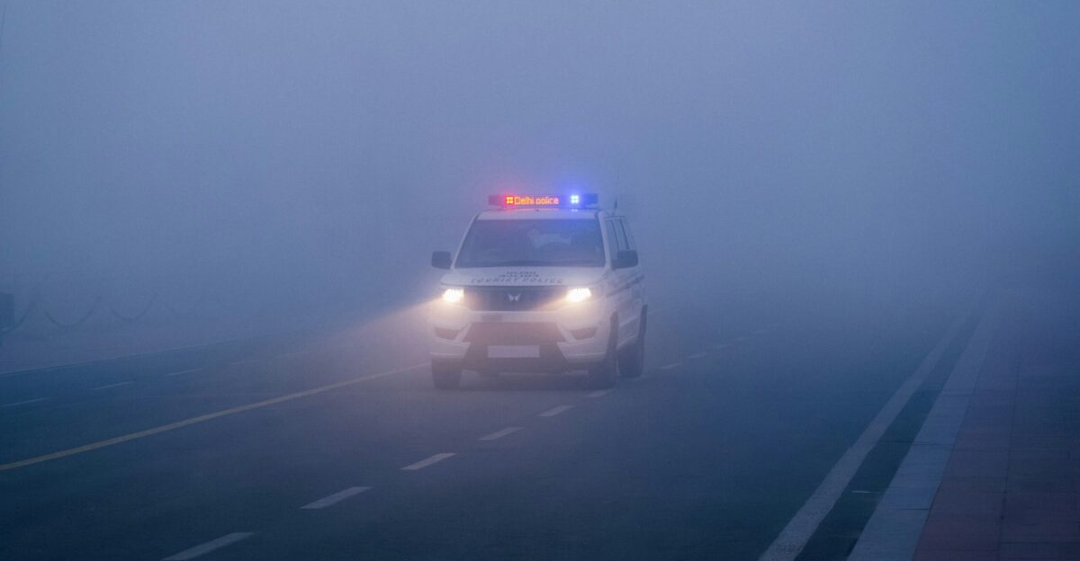
Visibility Collapsing to 10 Feet in the Worst Pockets

Tule fog is notorious for sudden, brutal drops in visibility. The National Weather Service warns that drivers can transition from clear conditions to a whiteout in seconds, with visibility plummeting to as little as 10 feet in the densest patches, making it nearly impossible to react in time.
Level 3 on the agency’s five‑tier fog severity index—now in effect across much of the valley—means moderate risk and visibility around half a mile.
NWS Labels Conditions a ‘High Transportation Risk’
The National Weather Service office in Hanford has issued repeated dense fog advisories for the San Joaquin Valley, warning of a “high transportation risk” as visibility drops along major corridors.
A Newsweek summary of the alerts notes that meteorologists have urged people in central California to avoid travel until the thick fog lifts.
Interstate 5 and Highway 99 Turn Into Blind Freeway Tunnels
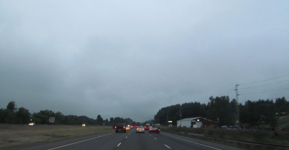
Critical freight and commuter routes—Interstate 5, Highway 99, and several connecting highways—run straight through the fog belt, forcing drivers to navigate what amounts to a moving tunnel of gray.
Dense fog advisories from the Hanford office specifically call out these routes, warning that visibility may drop to a quarter‑mile or less.
Foggy Freeways Meet Trapped Pollution

As the fog spills west, it’s colliding with a separate air‑quality problem. Just before Thanksgiving, the Bay Area Air Quality Management District issued its first Winter Spare the Air alert of the season, banning most wood burning as light winds and cold nights were expected to trap smoke near the ground.
Officials warned that high pressure over Northern California would act “like a lid, trapping smoke at ground level”.
Smog, Wood Smoke and Vulnerable Lungs
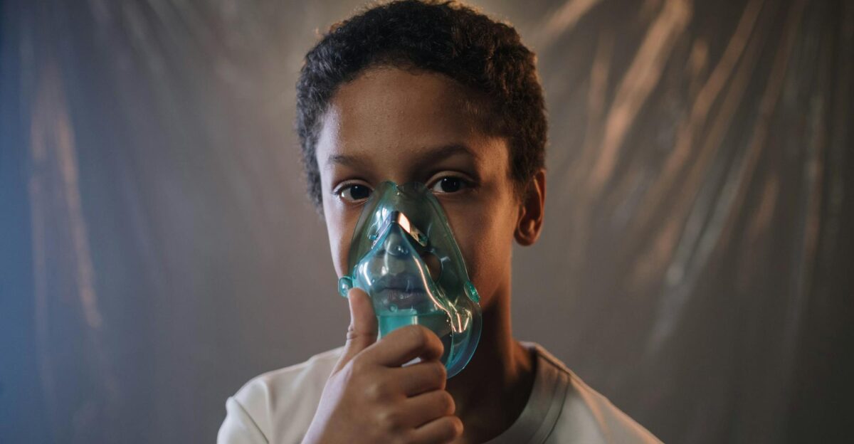
District officials say wood smoke is the leading source of winter air pollution in the Bay Area, and that a combination of increased holiday burning, cold overnight temperatures, and stagnant air can rapidly push fine‑particle pollution to unhealthy levels.
They compare wood smoke to cigarette and wildfire smoke, warning it can worsen asthma and increase the risk of heart attacks and certain cancers, especially for children, older adults, and people with respiratory disease.
Thirteen Million Daily Lives Rewritten

From farmworkers heading into orchards before dawn to parents driving children to school on Highway 99, the fog is reshaping daily routines across a region of roughly 13 million people. Commuters contend with slower trips and sudden slowdowns.
Health officials, meanwhile, urge residents to check both weather and air‑quality alerts before stepping out each morning.
Clear Skies and Calm Winds Built the Wall
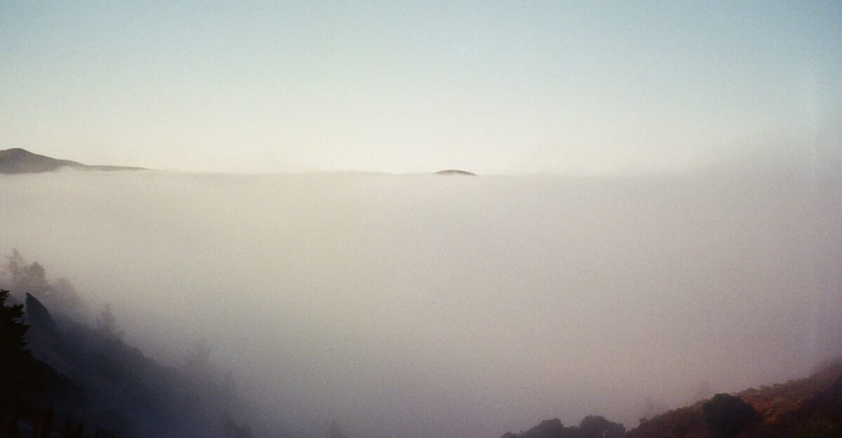
Meteorologists describe this event as a near‑perfect recipe for Tule fog. A cool, moist layer of Pacific air sits close to the surface, left behind by autumn storms. Clear skies above allow the ground to radiate heat into space at night, cooling the air until it reaches saturation.
Light winds mean that the chilled, saturated layer just stays put, thickening into exceptionally dense fog in the Central Valley’s geographic “bowl”.
Why the Fog Lingers Instead of Lifting
Under more typical conditions, the morning sun eventually warms the surface enough to mix and dissipate radiation fog. This time, forecasters say a stubborn pattern of high pressure and weak mixing has allowed the fog to linger, sometimes well into the day.
With moisture trapped near the ground and only shallow afternoon clearing in many spots, the atmosphere resets each night, primed for another round of pre‑dawn whiteout.
Longest Fall Tule Fog Stretch in Years
Sacramento just endured its longest stretch of autumn fog in years, according to the San Francisco Chronicle’s weather coverage. The National Weather Service office there issued nine dense fog advisories in November, the most at this early stage of the wet season since at least 2005.
Locally, residents know this as Tule fog, but scientists classify it as radiation fog—a recurring winter hallmark of the Central Valley and, increasingly, nearby Bay Area valleys.
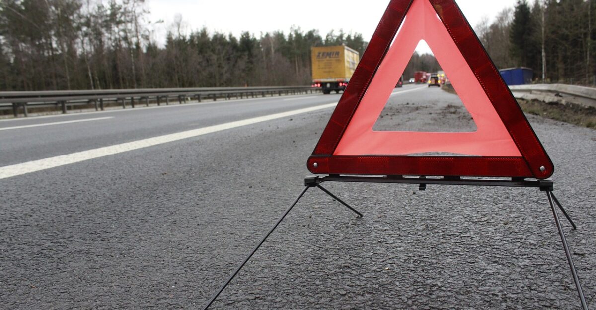
When Fog Turns Freeways Deadly
Transportation researchers and local officials note that Tule fog has a long and grim history on Central Valley highways. A federal safety study documents multiple multi‑vehicle crashes in the region’s fog belts, including a notorious 108‑vehicle pileup near Fresno in 2007 that killed two people and injured nearly 40.
Law enforcement agencies say visibility can drop so quickly that even cautious drivers have little time to react.
Slow Down, Stay Visible
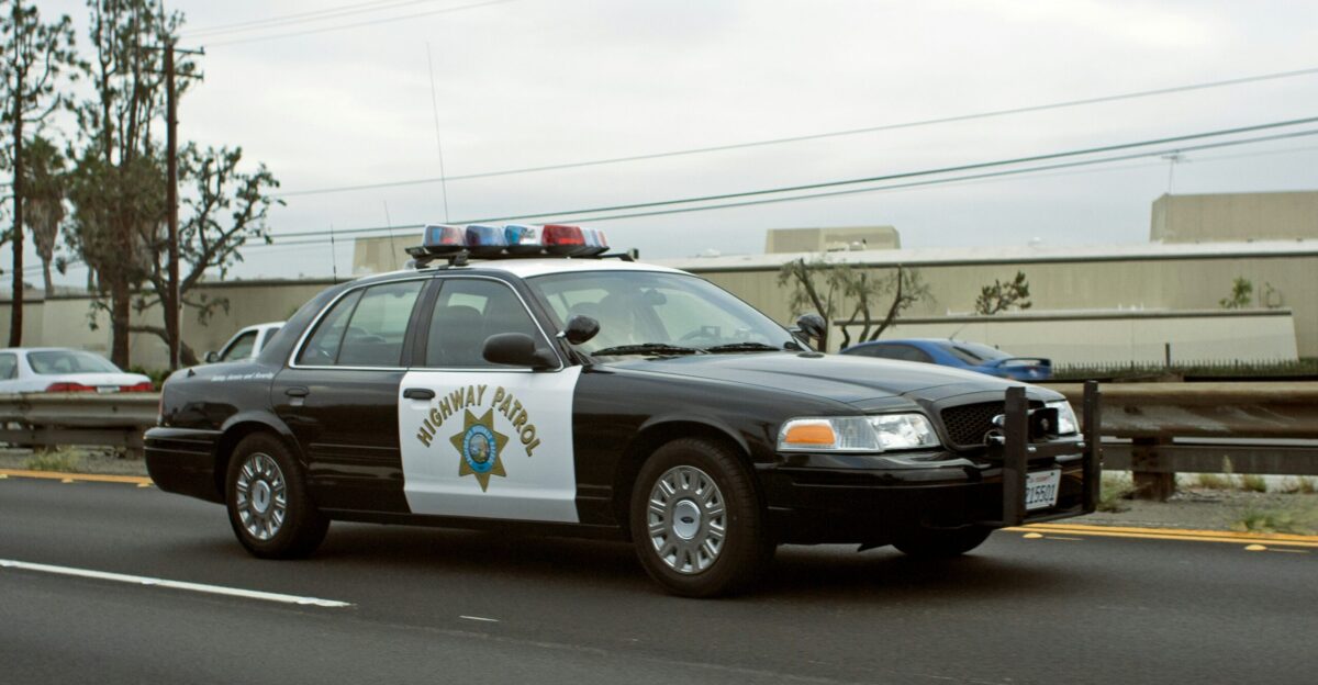
California Highway Patrol officers advise drivers to treat dense fog much like a dust storm: reduce speed, increase following distance, and resist the urge to “push through” if you can’t see, spokesman Mike Salas told Fresno station KFSN in a separate fog and dust advisory.
The National Weather Service advises motorists to use low-beam headlights, avoid stopping in travel lanes, and never rely on high beams, which only glare back in the fog.
Why the Shoulder Can Be a Trap
Traffic safety guidance from CHP and legal summaries of past pileups stress a counterintuitive rule: don’t stop on the freeway in thick Tule fog unless absolutely necessary.
In multi‑car crashes near Bakersfield and Fresno, investigators have found that drivers who stopped in lanes or on narrow shoulders were hit by vehicles that never saw them in time. Experts say pulling off at an exit, if possible, is far safer.
Fog That Kills on Highways
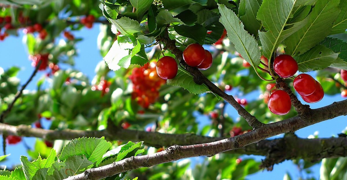
While motorists fear Tule fog, many growers quietly depend on it. Agricultural researchers note that Central Valley orchards—almonds, peaches, cherries, and pistachios among them—rely on cold, foggy winters to meet “chill hour” requirements that help trees rest before spring growth.
As thick winter fog has declined over recent decades, some studies link the change, along with warming temperatures, to added stress on fruit and nut crops.
Cleaner Air, Fewer Fog Days
Scientists at UC Berkeley and other institutions say the Central Valley’s thickest fogs have become less common since the 1980s, mainly because stricter air‑pollution rules reduced the tiny particles that help fog droplets form.
Yet this fall shows that when the right pattern returns—recent rain, calm winds, long nights—the valley can still generate dangerous, days‑long fog events, even as broader climate trends reshape when and how often they occur.
The Psychological Shock of Driving Into a White Wall
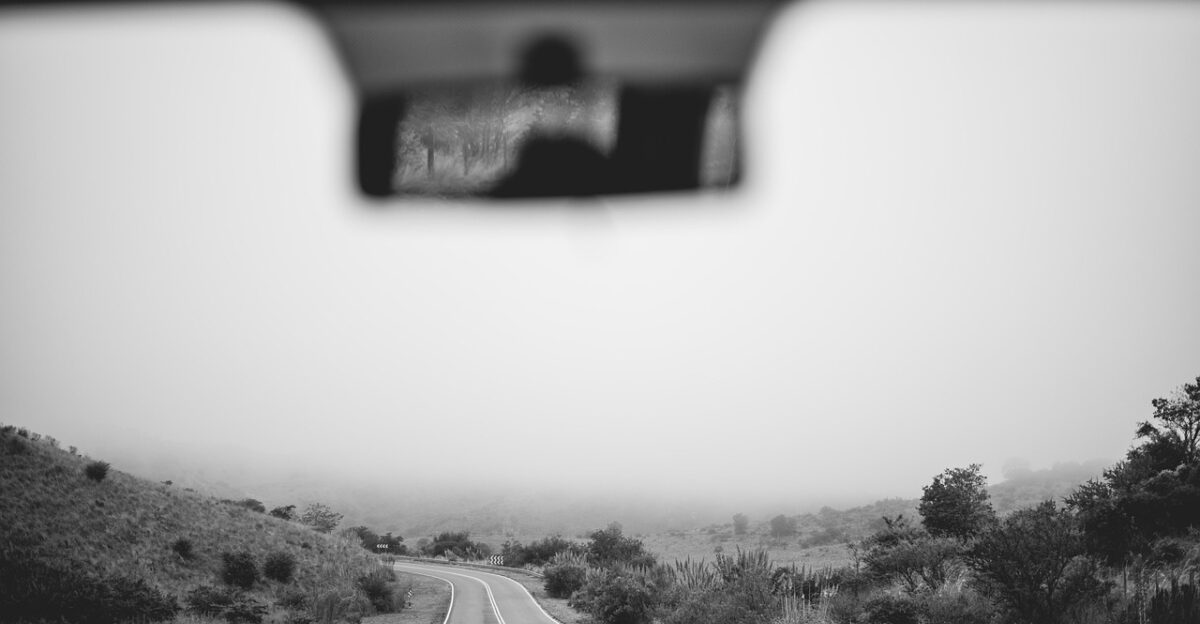
Veteran forecasters say one of Tule fog’s most dangerous traits is how abruptly it appears. SFGATE reports that the National Weather Service warns drivers can misjudge their speed as they enter the fog, losing all visual reference points and over‑driving what little they can see.
Experts liken it to suddenly driving into a tunnel with no walls—only a flat sheet of white—where brake lights or hazards may be visible only at the last instant.
What’s Next for California’s 400‑Mile Fog Belt
The National Weather Service expects the fog to continue rebuilding at night across the Central Valley, with parts of the region repeatedly reaching Level 3 on its fog severity index—moderate risk, visibility around half a mile—forecasters said in early‑December discussions.
With high pressure and light winds still in place, more dense fog advisories and air‑quality alerts are possible. For now, officials urge residents to assume the fog will return tomorrow.
Sources:
National Weather Service, Hanford and Sacramento forecast discussions and dense fog advisories for the San Joaquin Valley and adjacent corridors, late November–early December 2025.
Bay Area Air Quality Management District, Winter Spare the Air alerts and wood‑burning ban notices for the Bay Area, November 24–26, 2025.
SFGATE and San Francisco Chronicle weather coverage of Central Valley and Bay Area Tule fog extent, duration and satellite imagery, November–December 2025.
California Highway Patrol and KFSN‑TV Fresno public safety guidance on driving in dense fog and dust, 2024–2025.
UC Berkeley–affiliated and other peer‑reviewed research on Central Valley winter fog trends, air pollution controls and agricultural chill‑hour impacts.