California’s 40 million residents are preparing for extreme weather as a storm moves toward the coast. This storm could bring strong winds, flooding rain, and dangerous ocean conditions. The National Weather Service (NWS) warns of widespread power outages and hazardous travel this weekend.
The storm’s development is part of a larger pattern of atmospheric instability sweeping the Pacific region, which experts say could bring California another rough weather weekend.
From Sunshine to Storm Watch
Just days ago, much of California was basking in golden sunshine and warm breezes thanks to Santa Lucia winds. But now, those peaceful skies are numbered. A cooler marine layer moves inland, replacing warmth with moisture and clouds. It’s the calm before the storm, meteorologists say.
By midweek, coastal residents will notice thicker air and chilly mornings, a sign that the Pacific system is gaining strength offshore. Beachgoers and travelers should expect a rapid change, as this early cooling trend kicks off a dramatic transition into stormy, windy conditions across the state.
Weather Turning as Winds Shift
The high-pressure zone that gave California its pleasant weather is losing strength, and new northwesterly winds are on the horizon. Moist sea air will soon replace dry inland breezes, and according to the NWS, this change sets the stage for a cyclone to develop.
Residents may feel the first hints of stronger gusts and cooler mornings. These gradual changes might seem minor, but they’re the early signals of incoming severe weather, especially for Northern and coastal California.
Mild Temps Before the Storm

Most of California will hold steady with mild temperatures from Tuesday through Friday before weather chaos begins. Inland valleys could reach the upper 70s to low 80s, coastal valleys hover in the mid-70s, and beaches stay in the low to mid-70s.
But this comfortable spell won’t last. Warm air trapped inland will soon collide with cold storm systems from the north, driving gustier winds and temperature drops.
Early Signs of Trouble
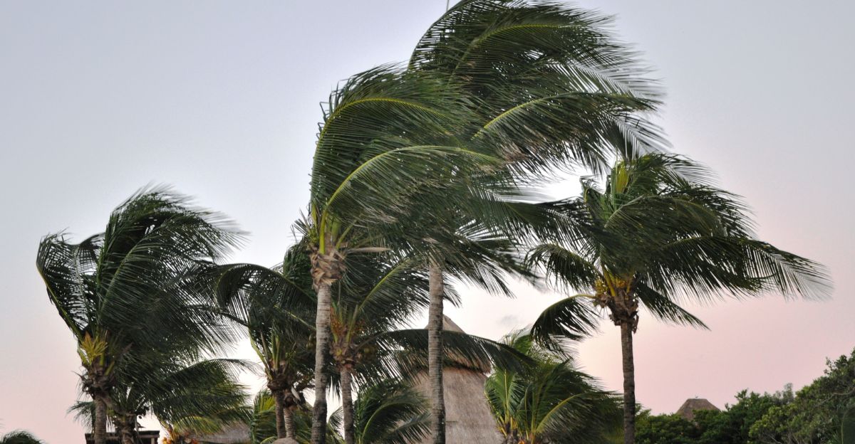
A low-pressure system is beginning to strengthen along the California coast. Early in the week, winds between 8 and 18 mph will start pushing moist ocean air deeper inland. While not yet dangerous, these breezes stir up weather ingredients that could develop into something far more powerful.
As the air grows unstable, conditions will slowly intensify. Expect shifting skies, light gusts at first, then rougher coastal winds. This pattern may feel typical for autumn, but scientists stress that this low-pressure event is unusually strong for October.
Foggy Nights and Low Visibility

Coastal Californians should brace for nights filled with low clouds, heavy fog, and drizzle. The NWS says visibility could drop sharply, especially before sunrise, making driving and marine travel risky. Inland communities will get some spillover, but the densest patches will hug the shoreline.
Morning commuters should plan extra time and use headlights, not high beams. While drizzle might seem harmless, roads can quickly become slick after long dry periods.
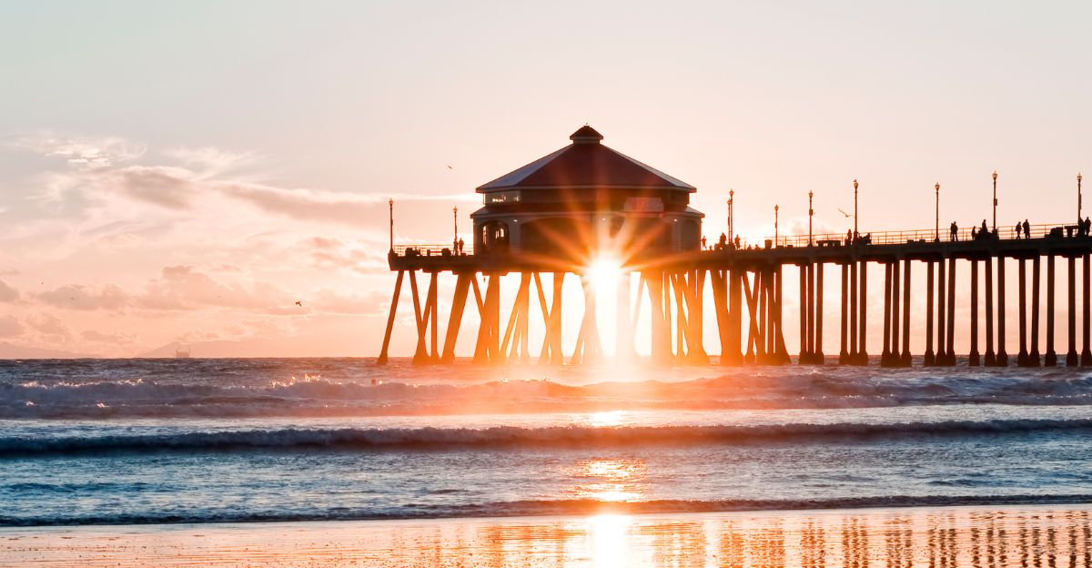
Ocean Hazards on the Rise
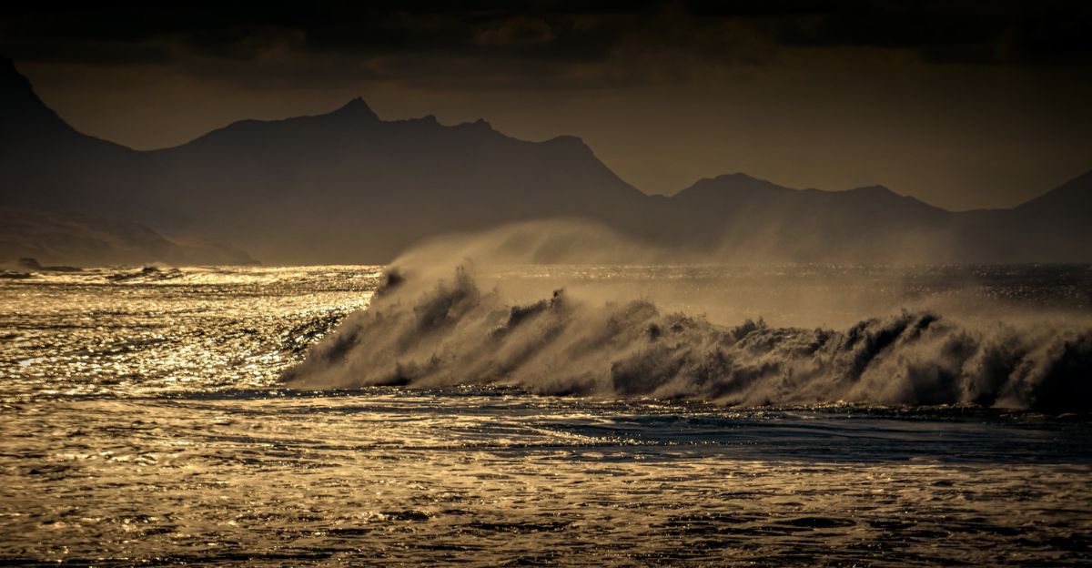
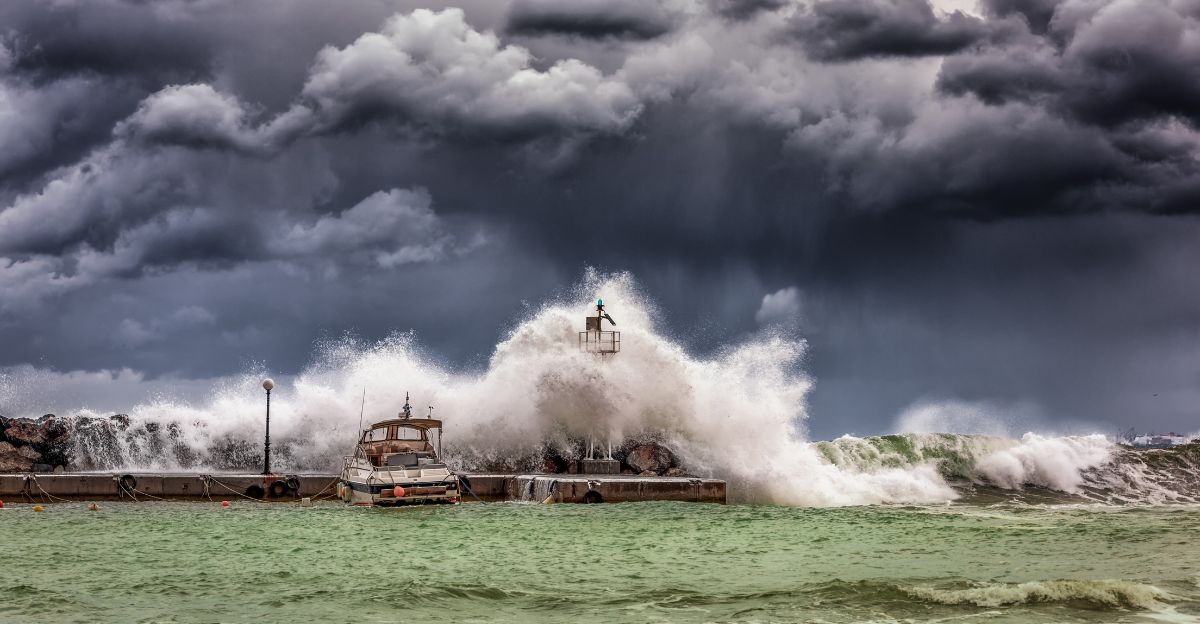
Powerful waves and rip currents will lash California’s coast starting Sunday evening. The NWS issued a Beach Hazards Statement for all Pacific beaches through Monday night. Waves could reach dangerous heights, particularly along the San Francisco Bay Area.
Rip currents, strong underwater channels that pull swimmers away from shore, will be common. Visitors are urged to avoid jetties, rocks, and low-lying coastal paths. “A Beach Hazards Statement is in effect from 8 PM tonight through 8 PM Monday for all Pacific Coast beaches. A long northwesterly swell will increase the risk for sneaker waves and rip currents. Never turn your back on the ocean!” the NWS says.
Clearer Inland, Cloudy Coast
While the coast stays cloudy, inland areas and some valleys will see sunshine break through by late morning. However, beach towns may stay gray and misty most of the day. The clearing air won’t mean calm weather, though.
These temperature and cloud contrasts create turbulence, helping fuel stronger gusts later in the week. For those traveling between coastal and inland regions, expect rapid visibility changes and shifting winds as the storm system strengthens offshore.
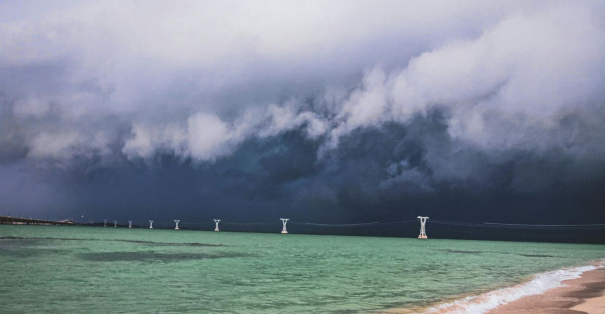
The Bomb Cyclone Forms
By the weekend, the main event begins: a massive storm charging down from the Gulf of Alaska will hit Northern California. This system is set to drop in pressure by 24 millibars within 24 hours.
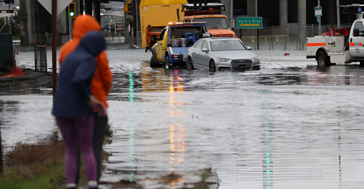
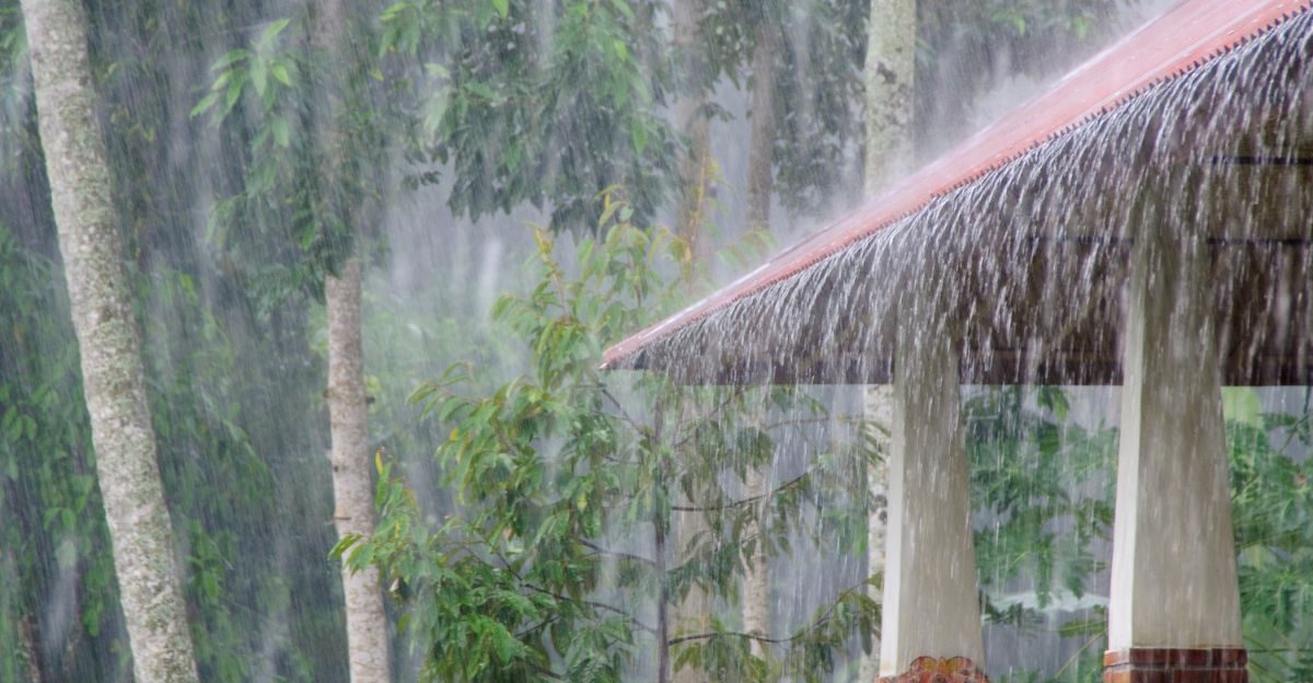
The result? Torrential rain, hurricane-like gusts, and surging surf. Coastal highways could flood, and mountain passes may face slick, wind-driven rain. Emergency teams are preparing now to respond swiftly as the powerful weather front approaches.
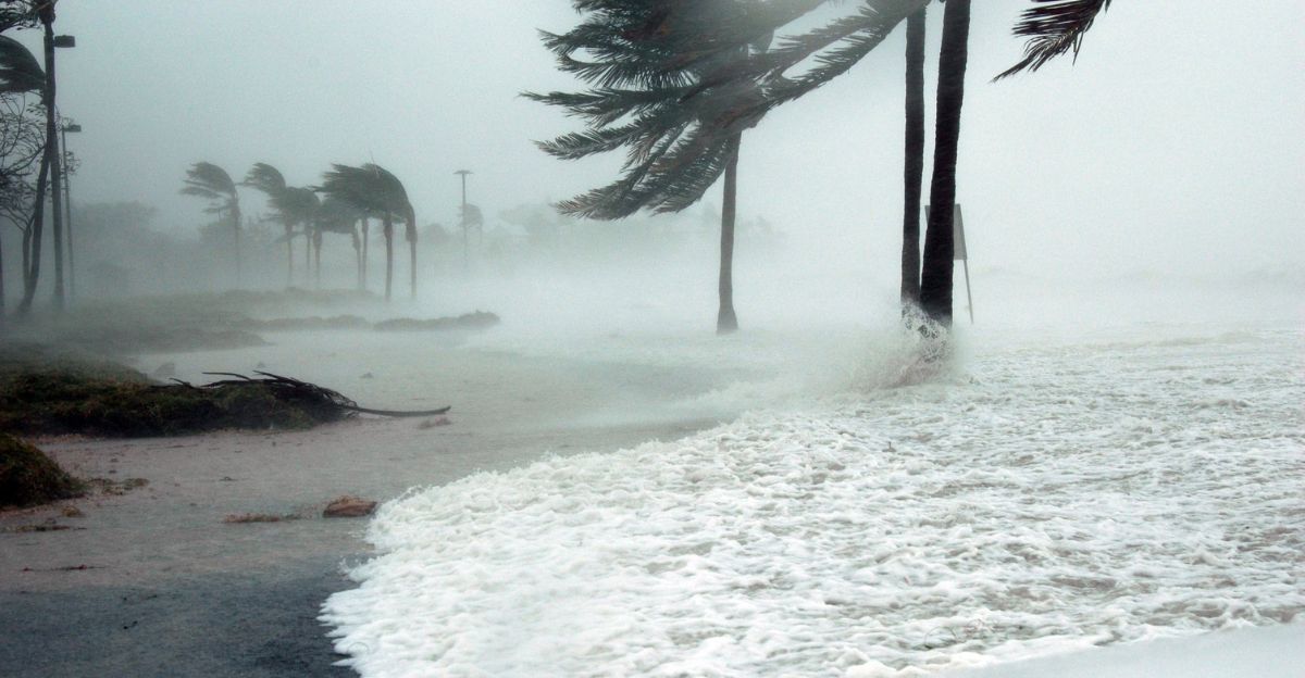
How Strong Will It Get?
Forecasts suggest the storm’s pressure will bottom out around 966 millibars by Saturday night as it nears Oregon’s coastline. Winds could reach near-hurricane force in some exposed parts of Northern California.
Expect trees down, scattered outages, and flying debris. Torrential rain will accompany these gusts, causing flooding in low-lying or burn-scar regions. Coastal communities from Eureka to Mendocino could be hardest hit, while inland valleys contend with windborne debris and blocked roadways.
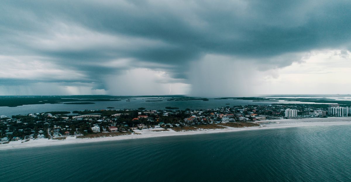
What to Expect from the Rain
Weekend rainfall will vary by region. Northern Santa Barbara and San Luis Obispo counties could see between one-third and half an inch of rain. Heavier rainfall is expected farther north, especially north of the Bay Area.
While these amounts may not cause severe flooding, rapid bursts of rain can overwhelm drainage systems. The heaviest rain is expected Saturday night, likely tapering by Monday morning.
Power Outages and Wind Threats

With intense winds and pounding rain, damage to power lines is a major concern. Falling branches and debris could lead to widespread outages. Residents should charge phones, flashlights, and external batteries while power is still steady.
If the power goes out, avoid touching downed wires, and report outages immediately.
Ready, Set, Prepare

Californians are urged to act now before the storm’s full arrival. Keep vehicles fueled in case of evacuation orders. Outside, tie down loose furniture and cover electronics.
Stay alert through official channels like emergency texts, local radio, or weather apps. If you live near the coast or in wildfire burn zones, keep a go bag ready with documents and essentials.
What Each Region Can Expect
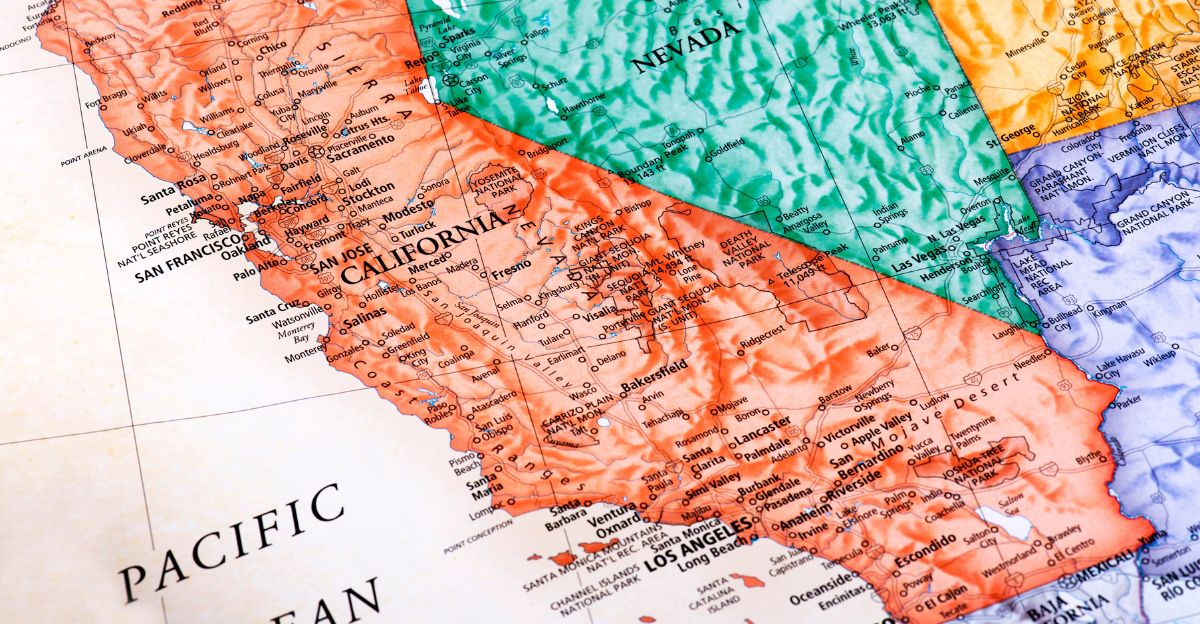
Northern California will see the storm’s worst, howling winds and heavy rainfall. Central California will face gusty winds and intermittent showers, while Southern California may see scattered rain and minor flooding in low spots.
Local authorities across the state are ready to respond quickly to fallen power lines, landslides, and hazardous surf. Californians are reminded that even if their area escapes the worst, travel and communication networks could still be affected statewide.
Outlook Beyond the Weekend
After the weekend’s intense storm, Monday is expected to bring major improvement. Clearer skies and drier air will return to most of the state. Forecasters expect calm weather to last through midweek, allowing cleanup and repairs to begin.
For now, the focus is on safety, recovery, and the resilience Californians always show in the face of nature’s power. Stay alert, stay connected, and check in on your neighbors.