
A powerful disruption in the atmosphere high above the Arctic is reshaping winter across the United States. A Sudden Stratospheric Warming event has weakened the polar vortex, the high-altitude ring of winds that typically keeps frigid air confined near the North Pole. As this disruption unfolds, Arctic air is pouring south, creating an exceptionally cold and snowy pattern that is driving dangerous conditions for tens of millions of people.
Historic December Cold and Snow
December 2025 has emerged as one of the coldest and snowiest months in years for much of the country. Temperature anomalies show readings 15 to 30 degrees below normal across most of the United States, with the Southwest a notable exception. A slackened polar vortex, combined with a weak La Niña in the Pacific, is steering bitter air as far south as the Gulf Coast—an outcome forecasters describe as highly unusual in recent decades.
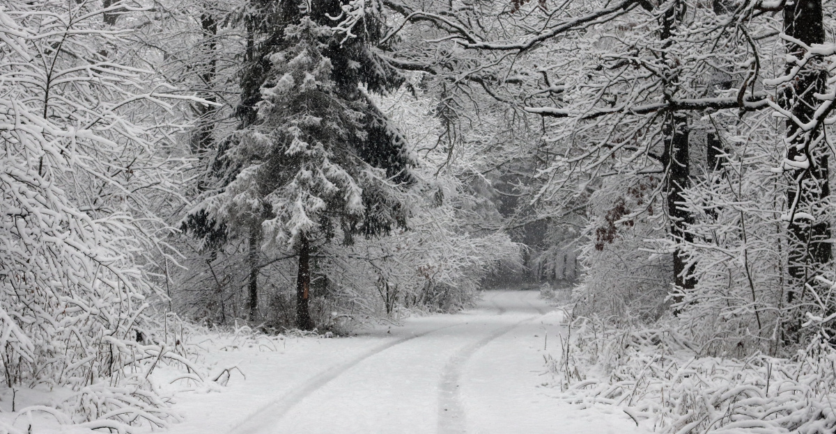
The cold set the stage for repeated snow events, including intense lake-effect outbreaks around the Great Lakes. From late November into early December, downwind communities absorbed extraordinary snowfall. Some areas saw more than six feet. Erie, Pennsylvania, set a new November record on November 29 with 22.6 inches, the most since 1893. In Perrysburg, New York, 30.6 inches fell on November 30, eclipsing a 22-year record. Warm lake waters meeting incoming Arctic air fostered narrow, persistent snow bands that buried neighborhoods and foreshadowed the larger storm to come.
Storm Preparation and Multi-State Warnings
By December 13, emergency officials across the Northeast were on heightened alert as models converged on a strong coastal system. Governor Phil Murphy declared a state of emergency for five northern New Jersey counties. Pennsylvania lowered speed limits on major interstates ahead of the storm. Hospitals added supplies, and highway departments pre-positioned salt, sand, and plows.
The National Weather Service issued Winter Storm Warnings and Advisories across multiple states, signaling an event expected to be both disruptive and widespread. As a coastal low reorganized off the Delmarva Peninsula, forecasters stressed that travel would be dangerous, not just inconvenient.
On December 14–15, official winter storm warnings were in effect for parts of Pennsylvania, New Jersey, West Virginia, Maryland, and Alaska. Pennsylvania was forecast to receive up to 12 inches of additional snow, with wind gusts approaching 45 mph. Central and northern New Jersey prepared for 4 to 6 inches, while Western Maryland’s Garrett County faced 4 to 10 inches. Sections of West Virginia were under similar warnings. In Hyder, Alaska, predictions ranged from 11 to 15 inches, with some outlooks calling for as much as 22 inches. Together, these alerts reflected a single, far-reaching weather system intertwined with an already extreme cold pattern.
On the Ground: Crashes, Outages, and Closures
Western Pennsylvania emerged as one of the hardest-hit regions. Westmoreland County, in the Pittsburgh metropolitan area, experienced heavy snow driven by 35–45 mph gusts, which sculpted deep drifts and slashed visibility to near zero. In northwestern Pennsylvania, lake-effect bands added 2 to 3 inches on top of the main storm, with localized totals of 4 to 5 inches. Schools closed, and highways imposed further speed restrictions as conditions deteriorated.
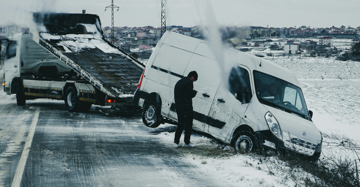
The human toll mounted quickly. By the morning of December 14, a 20-year-old man had died in a crash on Long Island’s Southern State Parkway, with authorities citing wintry road conditions. Additional storm-related fatalities were reported elsewhere in the region. Airlines struggled to keep up, with at least 1,000 flight delays and more than 100 cancellations at major airports.
State police agencies were stretched thin. Pennsylvania troopers responded to hundreds of wrecks and spin-outs. In Indiana, state police aided 81 stranded drivers and logged more than 315 crashes and slide-offs, as freezing temperatures and blowing snow turned highways into hazardous corridors.
Critical infrastructure came under strain. In New Jersey’s Mercer County, at least 2,000 residents lost electricity as demand surged and heavy snow weighed on power lines. At New York’s Kennedy International Airport, 4.6 inches of snow set a daily record and complicated de-icing operations. Perrysburg, New York, measured 23.7 inches during the main storm, piling nearly two feet of snow atop earlier lake-effect accumulations. Utilities contended with the combined impacts of blocked roads, line damage, and sharply higher heating demand, underscoring how systems designed for historical averages can struggle during climate extremes.
Millions Affected Across the Eastern U.S.
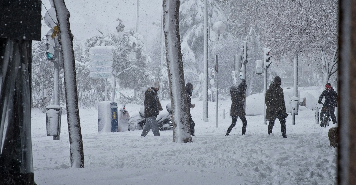
Although the most intense snow focused on a cluster of states, the broader pattern touched a far larger swath of the country. Around 60 million people across multiple regions were under some form of winter storm warning, watch, or cold advisory as the Arctic air mass expanded. In the Midwest, extreme cold watches stretched from Minnesota to Missouri, with lows near −22 °F in some locations. The Ohio Valley endured multiple feet of snow and major travel disruptions. Farther south, Virginia, North Carolina, and parts of the Southeast faced cold advisories unusual for these latitudes.
Within the five states under winter storm warnings on December 14–15, an estimated 9.67 million residents were in affected areas. Roughly 3.55 million people in western and elevated parts of Pennsylvania, about 5.29 million across central, northern, and southern New Jersey, around 796,000 in the warned zones of West Virginia, approximately 30,000 in Maryland’s Garrett County, and some 2,500 in the Hyder area of Alaska all faced severe winter conditions over the same 48-hour period.
Schools across primary impact states, including Pennsylvania, New Jersey, New York, and Maryland, closed or delayed classes on December 15, affecting millions of students at once. Districts leaned on remote learning systems where possible, but heavy demand revealed technical and logistical weaknesses. Families scrambled to arrange childcare, while administrators evaluated how repeated closures would affect academic schedules and heating budgets.
Official Advice and Questions of Preparedness
Amid dangerous wind chills and blowing snow, public safety guidance grew more urgent. The National Weather Service office in Pittsburgh issued a blunt directive urging people to remain indoors until conditions improved and emphasizing the need for layered clothing for anyone who had to venture outside. Frostbite and hypothermia warnings were widespread in Pennsylvania and Maryland, and officials in New Jersey strongly discouraged non-essential driving.
Some media descriptions referenced residents being “ordered” to stay inside, but the weather agency itself relies on advisory language—urging, warning, and advising rather than issuing legally binding commands. In practice, however, the combination of emergency declarations, road restrictions, power outages, and life-threatening exposure risks functioned much like a de facto stay-inside mandate.
Even as the December 14–15 storm system moved away, forecasters warned that the underlying cold pattern would persist. Arctic high pressure was expected to dominate the Midwest and Northeast through at least December 16 and likely beyond, with temperatures staying well below seasonal norms into the middle and possibly late part of the month. A brief milder interval was possible toward month’s end, but outlooks suggested additional winter systems could develop.
As communities dig out and repair damage, a larger discussion is emerging about winter readiness in an era of increasing climate variability. The polar vortex disruption and extreme cold do not fit simple narratives about a uniformly warming world, yet they are influenced by broader atmospheric shifts. Local and regional leaders are now assessing whether investments in plows, salt, energy resilience, and emergency planning were sufficient—or whether this December will become a catalyst for revisiting how to prepare for future episodes of severe winter weather.
Sources:
Wikipedia: December 13–15, 2025 North American Winter Storm
CNN: A Polar Vortex Disruption Is On The Way
Severe-Weather.eu: Winter 2025/2026 Final Forecast
USA Today: First Big Snow Storm to Hit US as Polar Vortex Sends Bitter Cold
NPR: Major Winter Storm Pummels the Northeast with Ice and Snow
Climate.gov: Record-Breaking Lake Effect Snow Arrives as Winter Starts