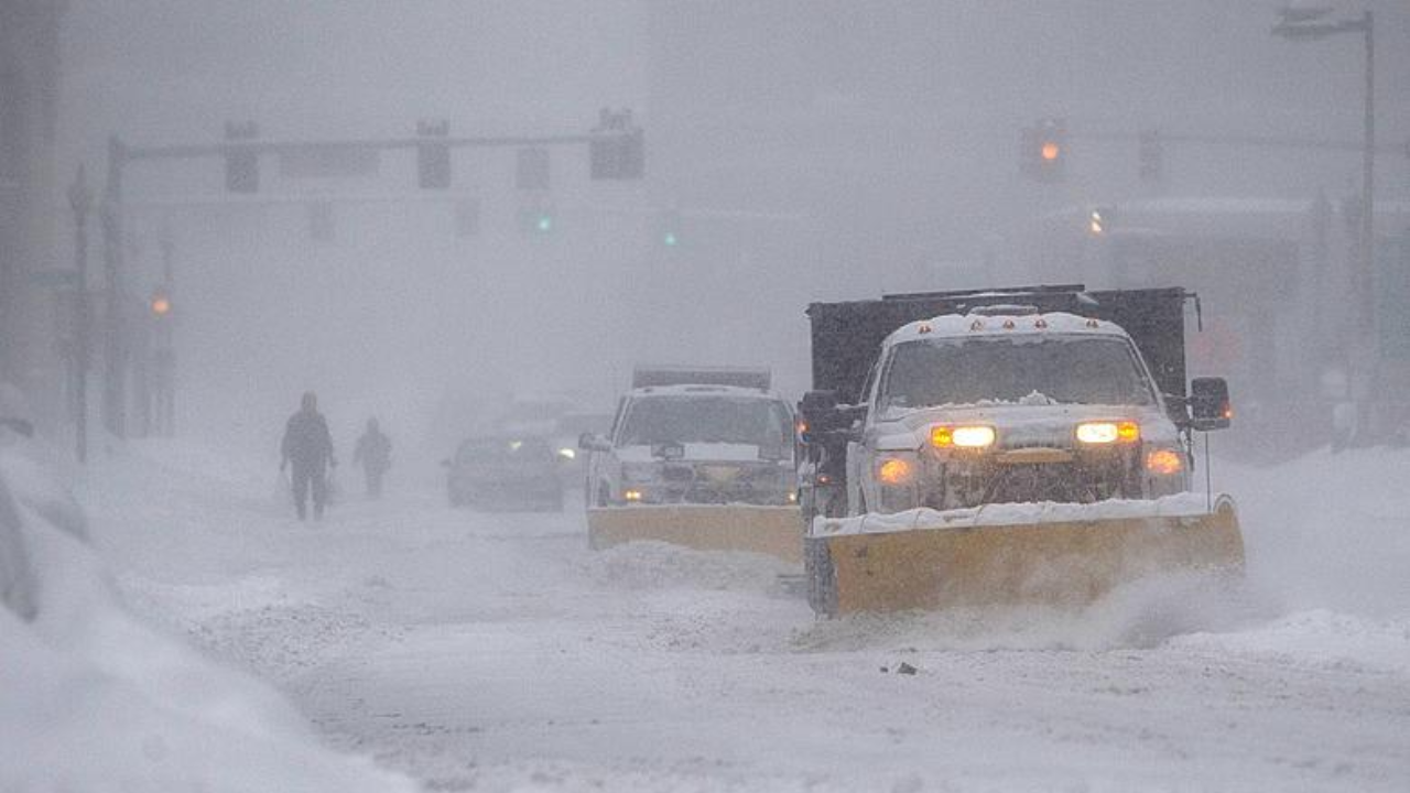
A ferocious lake-effect snowstorm slammed the Midwest and Northeast on January 14-15, 2026, shattering records and paralyzing communities from northern Indiana to southwest Michigan.
Record falls included 12.6 inches in South Bend, Indiana, surpassing the 1985 mark by 6 inches, while Niles, Michigan, tallied 16.4 inches by midnight on January 15. Bourbon, Indiana, saw 15 inches. Wind gusts reached 40-50 mph, slashing visibility to near zero and fueling snow at 2-3 inches per hour. A 30-vehicle pileup on the Indiana Toll Road near mile marker 94 trapped drivers, with one trucker trapped for several hours; emergency crews cleared the wreckage by 8 p.m., diverting traffic and treating minor injuries.
Forecast Escalation
Forecasters scrambled as the system intensified rapidly. Northern Indiana’s predicted snowfall doubled from 8 to 12 inches within a day. Arctic air plunged into the upper teens from the upper 30s, clashing with warm Great Lakes waters to spawn narrow snow bands stretching from Lake Michigan’s shore to Gas City, Indiana. Storm observers and meteorologists described the conditions as among the most intense lake-effect events in recent years, with high winds and near-zero visibility.
Lake Effect Genesis
This phenomenon arises when frigid air sweeps over relatively warm lake surfaces, absorbing moisture and heat to form towering snow-producing clouds. Optimal conditions require air at 5,000 feet to be 23 degrees Fahrenheit colder than the water. Lake Michigan’s persistent warmth powered the event, delivering relentless bands that dumped snow at nearly 2 inches per hour across the region.
Polar Vortex Trigger
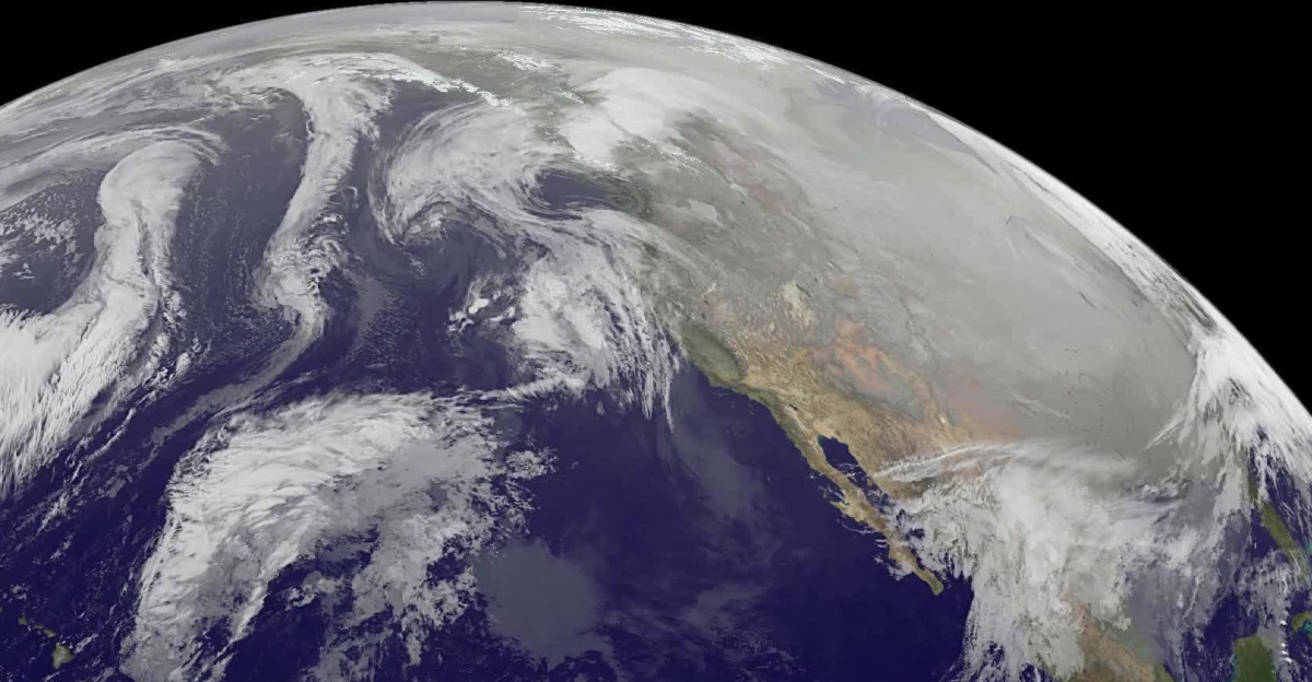
The onslaught marked the onset of a prolonged cold siege. A southward polar vortex shift ushered frigid air masses into North America. Meteorologist Ryan Maue cautioned of a potentially historic Arctic blast, with temperatures plunging 20-30 degrees below normal. AccuWeather foresaw peak chill in early February, stalled by a western high-pressure ridge blocking flow toward the Great Lakes.
Warnings Span Continent
National Weather Service offices issued winter storm warnings across 11 states, from Alaska to Tennessee, urging travel avoidance. Northern Indiana’s alert covered extremely difficult conditions from 5 p.m. Wednesday to 8 a.m. Thursday. Marquette predicted very challenging travel. The states included Indiana, Michigan, New York, Ohio, Pennsylvania, Tennessee, Alaska, Illinois, Maryland, West Virginia, and Minnesota. Advisories offered guidance, not mandates; road closures fell to state and local authorities.
Midwest Paralyzed
Northern Indiana and southwest Michigan bore the brunt, with snowdrifts clogging roads. St. Joseph County, Indiana, declared a travel advisory at 3:38 p.m. on January 14, deeming conditions hazardous and essential travel only. By January 15 morning, numerous vehicles had slid off roads, including two trucks. South Bend plowed main arteries overnight, reaching neighborhoods at 7:15 a.m.; county offices remained open. Over 400 Southeast Michigan schools shut, affecting hundreds of thousands of students, as did Detroit Public Schools and multiple county districts. Many Indiana districts shifted to remote learning. Resident Caentrell Carter shoveled out vehicles, noting the hassle but adding it had been fun. Businesses faced absenteeism; families juggled childcare.
Transportation Collapse
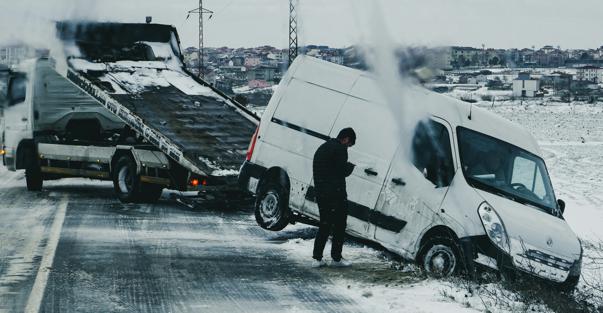
The Toll Road crash underscored perils, starting before 4 p.m. amid blinding snow. Vehicles, including trucks, blocked both directions; one crossed the median into a ditch. Hours of extrication followed. Regionally, Alaska logged heavy snowfall with strong winds, Tennessee 4-8 inches above 3,500 feet, New York 6-12 inches with subzero wind chills, Ohio 2-5 inches on icing roads, Pennsylvania 2-4 inches, Maryland wintry mix, and West Virginia 6 inches amid 40 mph gusts and minus-10 chills.
Government Response
Emergencies mobilized swiftly. Indiana’s Department of Homeland Security advised four counties; St. Joseph hit “watch” status, signaling public safety threats. Berrien County, Michigan, closed nonessential offices and the courthouse on January 15. South Bend crews prioritized thoroughfares overnight, leaving neighborhoods impacted longer. Berrien targeted secondary roads from 6 p.m. Subdivisions awaited plows 18-24 hours; side roads held a foot of snow. NWS advised sheltering indoors with supplies and charged devices for outages—standard precautions, not evacuations. Indiana activated advisories sans statewide bans.
Pattern Persistence
Meteorologists warned of ongoing threats. More Canadian cold surges and storms loomed through late January. Forecasters projected significant additional accumulation in southwest Michigan through the following week. Grand Rapids lagged in seasonal totals. AccuWeather meteorologist Brett Anderson attributed it to a jet stream dip funneling systems, though drier air curbed broader accumulations. The Climate Prediction Center anticipated temperature swings from 10-15 degrees below to 5-10 above normal.
As crews battled drifts and temperatures hovered in the low 20s, questions mounted over the polar vortex’s ferocity. Unfrozen lakes primed further outbursts, testing response capacities, budgets, and resolve amid a winter of extremes.
Sources:
Yahoo News, Winter Storm Coverage, January 13-15, 2026
National Weather Service Northern Indiana, January 14, 2026 Lake Effect Snow Report, January 14, 2026
Newsweek, Winter Storm Warning Coverage, January 14-15, 2026
CBS Detroit, School Closures and Winter Storm Impact, January 14, 2026
AccuWeather, Arctic Blast and Polar Vortex Forecast, January 12-14, 2026
USA Today, Arctic Blast Coverage, January 14, 2026